Kauai & The Na Pali Coast

Na-Pali-Coast

I am no slouch. I hike, run, bike, kayak, ski, and when I am idle, mentally pace about thinking about what I am going to do next. I say this because, despite all of my activities, backpacking the Na Pali Coast was a significant challenge of which I will not repeat.

Kauai is the northern most developed island in the Hawaiian chain. It is mountainous and beautiful and famous for its rugged landscape.

Hanalei and Haena are the two primary towns on the north side, and they are close to the trailhead for the Na Pali Coast. While they are my recommended places to stay, keep in mind that it does rain here more often. If you are the type that prefers golf, resorts, and sun bathing you might like the south side more.

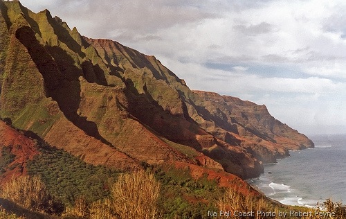
For the trip, I was joined by my wife, Julia, my stepbrother, Winslow and his wife, Katharine. We were all in shape and confident that we could tackle the 11 mile hike, which would lead us to the desired campsite situated at the base of fluted cliffs, ribbons of waterfalls, and the type of tropical scenery that one dreams about.

Continue reading Kauai & The Na Pali Coast

Traveling the Yucatan


For many people the Yucatan represents Cancun, the Mayan Riviera, and Chichen-Itza. While each of these locations posses many positive attributes for the wayfarer, there are many other reasons to travel to the Yucatan. Most flights do culminate at Cancun, but there are also air services to Merida and Campeche on the Gulf side of the Peninsula if you prefer to start there.

As you approach the Cancun airport, the first striking characteristic is the relative flatness of the terrain. Thick vegetation commands the landscape in an even blanket that stretches in all directions. The only thing breaking the even green is a lonesome road or a foreboding electric tower appearing larger than it should be considering the surroundings.

The reason the Peninsula is so flat is because it is entirely composed of a limestone shelf jutting out into the Gulf of Mexico and the Caribbean Sea. The layers of limestone are composed of the life and death of compacted ancient coral reefs and sand, which serve as a metaphor for the multi-layered human history that chiseled its own existence into the surface of this even terrain starting more than 12,000 years ago.

Built on time, stone, and water, human habitation of the Yucatan has always relied on the geologic composition. At first glance, one would surmise that there is no fresh water available in this flat landscape. Surface lakes and rivers are practically nonexistent, for they lay predominately underground. The spongy limestone has been carved from underneath by the slow erosive properties of water and time, and it has created a vast network of cenotes (wells) and connecting rivers fed by rain and springs, which bring life. A trip to the Yucatan would not be complete without a visit to one of the countless cenotes that pock the landscape.

Continue reading Traveling the Yucatan

Marlette Lake

Marlette Lake is situated above the East Shore of Lake Tahoe between Spooner Summit and Sand Harbor.

What is most notable about Marlette is the fact that it has been a source for trout fishing since 1887 when it was first stocked with Cutthroat Trout.

Today, it is still used as a source for Rainbow Trout eggs, which are gathered during spawning season in tiered gates that run into the south end of the Lake. They are then transplanted in both Lake Tahoe and Walker Lake.

Fishing is allowed on the Marlette Lake, but you must use barbless hooks. If you get lucky, it is catch and release.

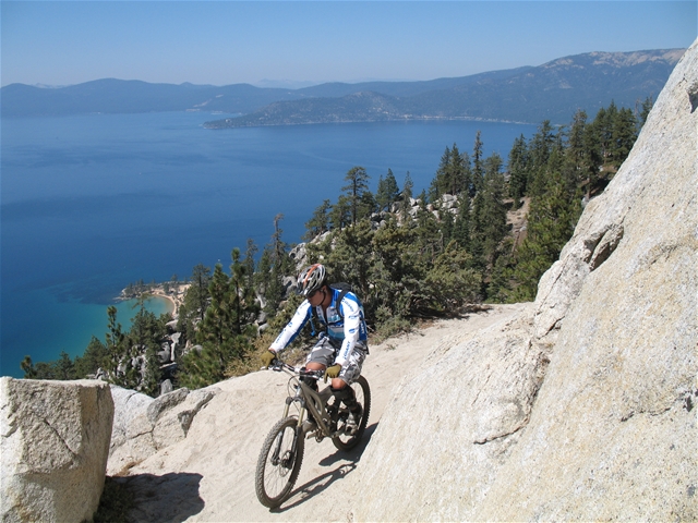
Marlette is also a popular area for mountain biking and hiking, and you will often see people circling the Lake to access the Flume or Rim Trail. Keep in mind that biking is only allowed on even days, so if you are planning a hike you might want to do it on an odd day. 

Regardless, it is beautiful, especially in the fall when the aspen leaves turn a vibrant gold and yellow. 

Roads & Rivers


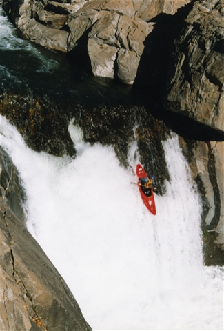
Any avid whitewater enthusiast can appreciate the commitment it takes to pack up the car and drive the many miles required to get to your favorite river. Generally, you also have to run shuttle, and then there is the long drive back home. You stare at the road through cracked capillaries produced by countless holes and the sun’s glare with a tired smile generated by the many miles of majestic scenery and quality whitewater. It is all very worth it, but if often comes at the expense of extensive wear and tear on the driver, his or her car, as well as a hefty gas bill at the end.

Hailing from the Southeast, driving to my favorite rivers was long, but not a journey of epic proportions. It was usually a couple of hours to the Green, Overflow, or Chattooga, and I never felt put out by it. When I moved to California 7 years ago, driving to the put-in took on a whole new meaning. Not only was the cost per gallon significantly larger, but also the distances were exponentially greater.

Continue reading Roads & Rivers

The intersection of business and lifestyle. Robert Payne | Seattle, Washington