Tag Archives: Hiking

Mount Si Trail Hike

After almost seven years in Seattle, I finally got up the gumption to hike Mount Si. It was not the four miles of vertical gain that dissuaded me, nor the call of more remote and pristine hikes. Rather, it has simply been the mountain’s extreme popularity given its close proximity to Seattle, Bellevue, Issaquah, and beyond.

Striking out on a warm and hazy Tuesday afternoon in mid May, I found the large parking lot about half full. It still felt like a lot of people to me, but throughout the hike I found enough spacing between those I encountered that the trail felt surprisingly peaceful overall. I do not know whether it is because the trail ranks so highly in searches for day hikes near Seattle, or because the outdoors have become a playground for so many new recruits, but proper etiquette dictates that hikers going uphill have the right of way. Let’s get it right, people.

Trail Highlights

I set a pretty good pace and reached the top in exactly two hours. The highlights included moss covered maples and ferns mixed with intermittent stands of large hemlocks at the beginning of the trail, a grove of 350 year old Douglas firs in the middle section, and of course the summit itself, with views of Mount Rainier, Snoqualmie Pass, Seattle, Bellevue, and the Middle Fork Snoqualmie meandering through the North Bend Valley below.

The Haystack

Do not be fooled by the false summit. The true top is the Haystack farther up the hill. The best approach is to continue along the trail and wrap around the back side of the Haystack, where you will find a steep Class III ascent. This route is not for everyone, so use your best judgment. People have fallen here and suffered serious injuries, including at least one fatality.

Trail Map

Once on top, it is tempting to descend and continue all the way out to Mount Teneriffe, then return via the Mount Teneriffe Trail, Talus Loop Trail, and Mount Si Trail. But I knew my winter feet were not ready for that distance, and I had not gotten an early enough start.

Geology

The top of Mount Si is made up of metamorphic rock that was once igneous rock formed beneath the ocean 150 million years ago. The valley below, unsurprisingly, was carved by glaciers. Nick Zentner, as always, does a great job explaining the geology in more detail. You will be dropping “metagabbro” into conversations at your next party. You’re welcome.

For all its reputation as Seattle’s crowded proving ground for hikers, Mount Si still manages to deliver. Ancient forests, sweeping views, deep geologic history, and just enough exertion to get you ready for more demanding and scenic hikes in the Cascade Range.
Brooker Creek Preserve

Feather Based on a tip from Tampa I Am, I decided to take a little stroll out at Brooker Creek Preserve this past Saturday. It sounded nice enough, and with its close proximity to downtown Tampa there was hardly any cause to consider it a huge commitment (even if it meant sacrificing precious weekend hours). Just throw the word, “preserve” into the same sentence with outdoors and hiking, and I am apt to be sold. Plus, how can one not be grateful for a morsel of land in the Tampa Bay area devoid of condos and mini porches with a compromised view?

Upon pulling into the parking lot, it seemed to be a nice enough place. I could hear some trigger-happy people popping off shots from their pistols somewhere in the distance, but aside from that there was relative calm. The boardwalk, albeit short, is quite nice, and the education center and corresponding facilities are obviously well-funded. The displays along parts of the trail are creatively composed and informative, but then they, well, just end.

Beyond that is the 4-mile wilderness trail, which I did in full, and while it held my observance I doubt I would ever do it again. Don’t get me wrong, there is subtle beauty in the pines and palms, but the trail was a road, and the pines had obviously been harvested not that long ago.

As further encroachment ensues land management becomes even more important and challenging. That is why I really am appreciative for places like this and would fork over additional tax dollars to protect more of the same. The diversity of wildlife, and the knowledge that one day those pines will be old growth is heartwarming. But it felt a little like being thankful for dissatisfaction. I wanted more!

I did have the chance to spy a pygmy rattler; although, I was not quick enough to capture a picture. I also picked up this turkey feather (see picture), and spotted a small buck cruising through the trees. In each case, I am glad they have room to roam.

Cypress Knees Julia Forest

Kauai & The Na Pali Coast

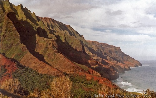
Na-Pali-Coast

I am no slouch. I hike, run, bike, kayak, ski, and when I am idle, mentally pace about thinking about what I am going to do next. I say this because, despite all of my activities, backpacking the Na Pali Coast was a significant challenge of which I will not repeat.

Kauai is the northern most developed island in the Hawaiian chain. It is mountainous and beautiful and famous for its rugged landscape.

Hanalei and Haena are the two primary towns on the north side, and they are close to the trailhead for the Na Pali Coast. While they are my recommended places to stay, keep in mind that it does rain here more often. If you are the type that prefers golf, resorts, and sun bathing you might like the south side more.

For the trip, I was joined by my wife, Julia, my stepbrother, Winslow and his wife, Katharine. We were all in shape and confident that we could tackle the 11 mile hike, which would lead us to the desired campsite situated at the base of fluted cliffs, ribbons of waterfalls, and the type of tropical scenery that one dreams about.

Continue reading Kauai & The Na Pali Coast